|
Terrain ImagesEach image here is linked to a full size version. Click on the image for a much larger version. Each image is approx 600x500.Fractal TerrainsThis images are of the combination of the fractal terrain generator with the colouring provided by the color ramp generator. Colouring is designed to represent a typical sea, sandy shore, green grass and snowy mountain tops.In some of these images, you will see a small coloured cross. This is the axis geometry and is located on the world origin so that you have a sense of perspective.
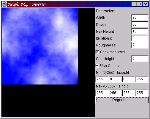
Heightfield ConversionsOne very popular use of the fractal terrain generation routines is to create cloud textures. Cloud textures take the 3D information and transform it to 2D and add some colour, so the effect is very simple to generate. Of course, using a 2D image means that you might want to go back as well.In the Cartographic/GIS arena, a very common way of sending around height information is in the form of images. A (typically) greyscale image contains a coded height value for each pixel. The shade of the pixel determines the height. The is the natural opposite of the height to image process, and both of these capabilities are available. The screen shots below show the different example applications and how you can create textures and height fields from images.
|
|
[ Home ]
[ License ]
[ javadoc ]
[ Online Examples ]
[ Download ]
[ j3d.org ] [ Aviatrix3D ] [ Code Repository ] [ Java3D ] [ OpenGL ] [ Books ] [ Contact Us ] Last Updated: $Date: 2010-01-27 21:36:00 -0800 (Wed, 27 Jan 2010) $ |